×

Accommodation booking
×
Mountains Valleys
Mountains Valleys
  • Today
    -3°C
    6°C
  • Thursday
    -3°C
    5°C
  • Friday
    3°C
    10°C
  • Saturday
    6°C
    12°C
  • Sunday
    10°C
    16°C

One country. One trail.

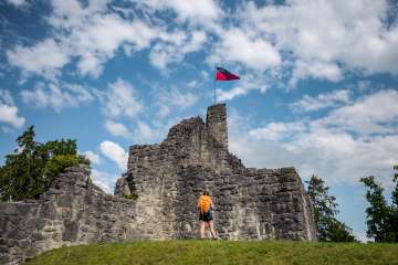
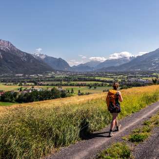
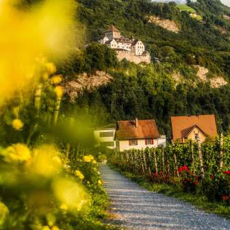
Explore an entire country on one trail: the Liechtenstein Trail offers 75 kilometers of exciting stories, sights and magnificent views of the surrounding mountains. It is suitable for outdoor enthusiasts and pleasure hikers equally and can be explored on foot or by bike. To ensure that you don't miss any attractions and can enjoy all the sights, we recommend planning a total of five to six days for the route. This can also be easily divided into weekends or several short stays. The trail leads through all 11 municipalities and past idyllic vineyards, impressive castles, peaceful nature reserves and panoramic sun terraces. With the bookable packages, included luggage transport provides the necessary extra relaxation. 

Liechtenstein Trail by bike
The signed cycle route deviates slightly from the hiking route in some places and is 85 km long, but you will still pass all the highlights of our country. To explore the route on two wheels, we recommend three daily stages.  

Ideal companion: LIstory app 
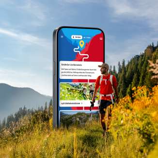
With the free LIstory app, 147 selected historical sites and sights along the Liechtenstein Trail are combined into one big picture. Even without the app, no one must miss out on the Liechtenstein Trail, as the route can also be enjoyed without the "LIstory" app thanks to physical signage along the trail. 

This trail really opened my eyes to what this often-overlooked country has to offer. Liechtenstein’s tourism board has done a spectacular job of making the trail relevant and interesting. There are 147 stops to “unlock” on a special app along the way with cultural and historical information. Using borrowed cell space, we had a few tech glitches. Overall, though, we were able to appreciate the whole experience.

JoAnna, a full-time freelance writer, public speaker, founder of Rooted

Information about the Route

  • The trail goes through all 11 municipalities of Liechtenstein
  • The hiking route is 75 km long, the cycling route 85 km 
  • Ascents/descents of 2,000 m/2,000 m
  • Min./max. altitude of 429 m/1,103 m
  • Overall walking time of 21 hours
  • The trail can go from south to north or north to south
  • It is possible to begin the trail from every municipality
  • Parts of the route are also accessible for people with limited mobility

Equipment
If you are exploring the Liechtenstein Trail on foot, hiking boots are recommended. Especially the sections Triesen-Triesenberg, Triesenberg-Vaduz, Planken-Nendeln and Ruggell-Schellenberg contain steep sections.

Route at a glance
Liechtenstein Trail route
Order free of chare the "Panorama map" with the Liechtenstein Trail inlcuded.

Bookable packages

"LIstory" App
Discover the history and culture of Liechtenstein in a new way with the free "LIstory" app.


#liechtensteintrail: Impressions from the Liechtenstein Trail

My webpage